

5.3 Wind speed maps, atlases and computer models
Maps and atlases specifically for wind energy purposes have been developed for many countries. Using long-term wind measurements and the WAsP computer model, a European Wind Atlas (Troen and Petersen, 1989) has been produced by the Risø Laboratory in Denmark. It includes maps of various areas within the European Union (for example, Figure 14), showing the annual mean wind speed at 50 m above ground level for five different topographic conditions: sheltered terrain, open plain, sea coast, open sea, hills and ridges.
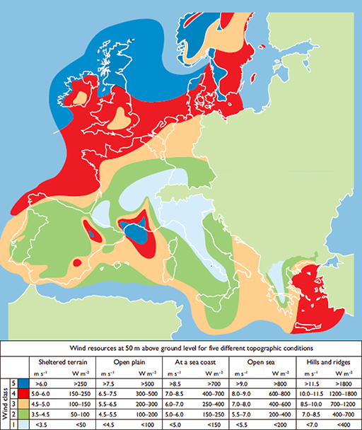
The atlas includes a series of procedures for taking account of site characteristics to estimate the wind energy likely to be available. These procedures work quite well on sites with a gentle topography but are not so good for very hilly terrain or urban areas. A similar atlas (included in Figure 14) has also been produced to cover the offshore wind energy resource in the European Union (Risø, 2009).