Skip to content
Skip to main content

About this free course

Download this course

Share this free course

The search for water on Mars

Start this free course now. Just create an account and sign in. Enrol and complete the course for a free statement of participation or digital badge if available.

This figure is a map of Mars. The map is rainbow colour coded from red to violet. Violet and blue colours represent low detection of silicates. Orange and red colours show high detection of silicates. The map is roughly divided into thirds from top to bottom (north to south). The top third is mainly grey, indicating no data was collected there. The next third (to the south) is mainly blue, showing low levels of silicates, with some green areas to the south. The next third south blue and green, indicating higher levels of silicates. The south polar region is coloured grey, indicating no data was collected there.
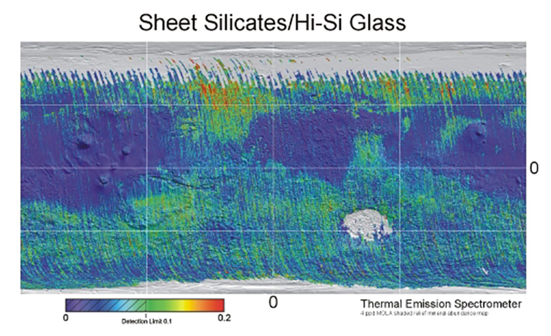
Figure 25 This map, based on data of the Thermal Emission Spectrometer aboard of the Odyssey orbiter, shows the location of sheet silicates - a synonym for clay minerals and silica rich glasses. Both types of minerals can only form in the presence of water. Image credit: NASA/ASU

 Mars Odyssey