Skip to content
Skip to main content

About this free course

Download this course

Share this free course

The search for water on Mars

Start this free course now. Just create an account and sign in. Enrol and complete the course for a free statement of participation or digital badge if available.

This figure is a map of Mars. It is colour coded from white, through browns, green, blue and violet. The colours are overlain onto a topographic map of Mars. Violet represents the highest amounts of water in the upper metre of the martian surface. White represents the lowest amounts of water in the upper metre of the martian surface. The martian poles are coloured dark blue. The remainder of the map is coloured light blue to brown. There is no obvious correlation with topography.
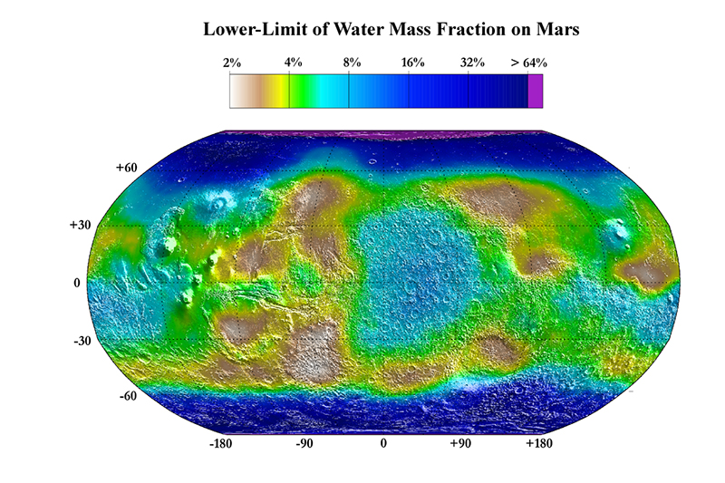
Figure 27 This map is the result of the GRS investigations of the martian surface and is based on the observation of hydrogen in the upper metre of the surface. Image credit: NASA/JPL/Los Alamos National Laboratory.

 Mars Odyssey