Skip to content
Skip to main content

About this free course

Download this course

Share this free course

The search for water on Mars

Start this free course now. Just create an account and sign in. Enrol and complete the course for a free statement of participation or digital badge if available.

This figure consists of two parts. The left hand side is a false-coloured topographic map of the martian surface at Nirgal Valles. It is mostly orange coloured, but circular features (imact craters) are green, indicating low elevation. In the centre of the image a long box is overlain, containing a smaller box, highlighting where HRSC observations were made. The right hand side is a repeat of Figure 14 – the greyscale photograph of the martian surface taken from orbit by the spacecraft Mariner 9. This is part of the same area as that shown in the left had photograph of this figure.
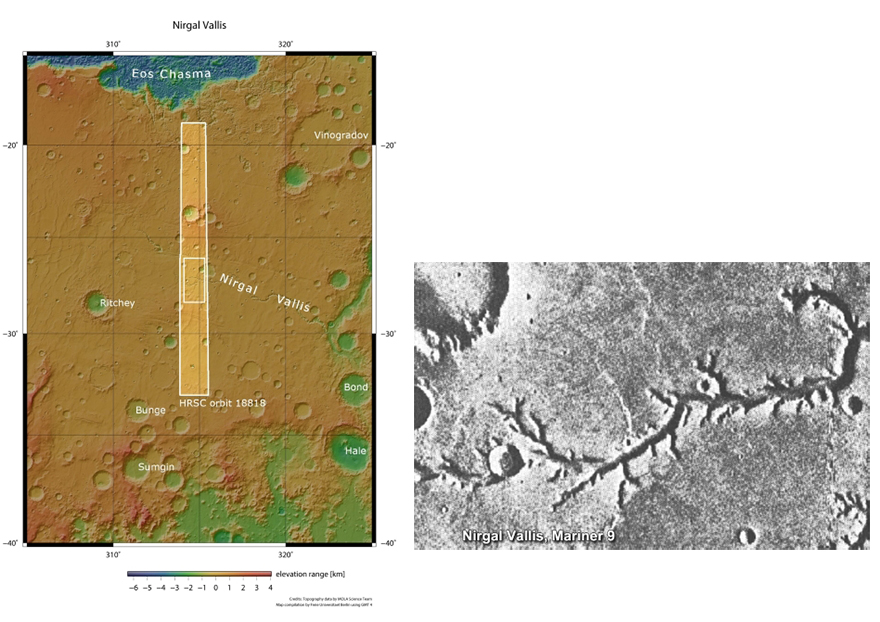
Figure 28 On the left-hand side, a context map for the HRSC observation of the stream bed at Nirgal Vallis. The boxes indicate the HRSC observations made in November 2018. Image Credit: ESA. On the right-hand side, a repeat of Figure 14, the greyscale image of Nirgir Vallis taken by Mariner 9. Image credit: NASA.

 Mars Express