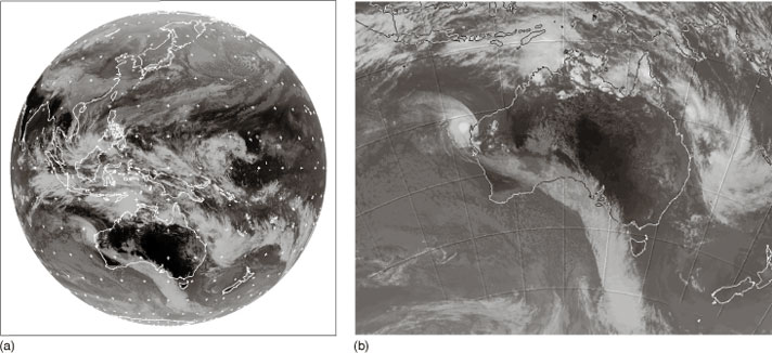
Figure 12 MTSAT geostationary satellite infrared images taken at 0630 UTC on 19 February 2008 showing (a) the whole globe, centred on longitude 140° E, and (b) a reprojection of (a) for the area around Australia and New Zealand.

Personalise your OpenLearn profile, save your favourite content and get recognition for your learning

Start this free course now. Just create an account and sign in. Enrol and complete the course for a free statement of participation or digital badge if available.