
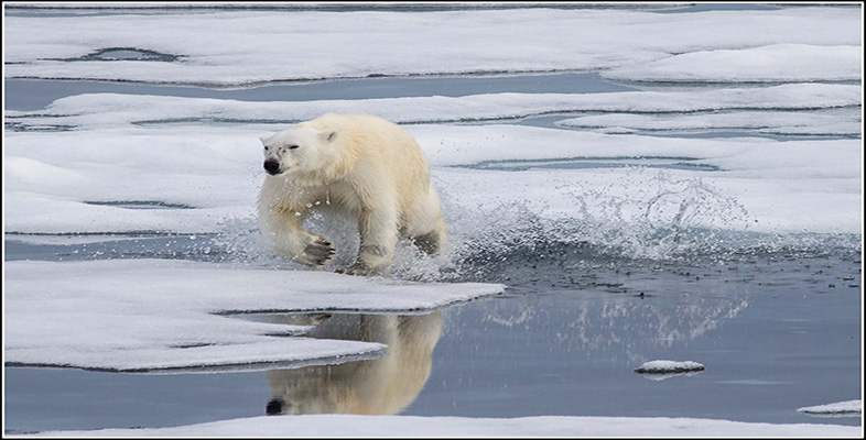
6.1 Habitats and temperatures: defining the Arctic
The difference in temperatures between Greenland and the Shetlands demonstrates that latitude – and as a consequence the amount of solar radiation received at the surface – cannot be used to define the Arctic. But what if you used temperature instead of latitude? In Africa Mount Kilimanjaro is 5895 m high and is relatively close to the Equator. Around its base is a vast diversity of trees, other plants and wildlife, but as you ascend the mountain, temperatures decrease and the diversity of plants and wildlife decrease as well. Pretty soon, if you keep climbing up, you will notice the density of trees thinning and becoming sparse, until eventually you will leave them behind. Above the line of trees (the so-called treeline), it is relatively barren compared with the base of the mountain. Keep ascending and temperatures continue to fall and eventually you will reach snow. On Kilimanjaro the temperature decreases with height – but on Earth, whilst the temperature clearly does not follow lines of latitude, it will decrease as you head towards the North Pole.
If you start on the Canadian border in a forest, what do you think will happen to the number of trees as you head northwards towards the pole?
As you head towards the pole the temperature will decrease and, just like climbing Kilimanjaro, the number of trees will decrease until eventually they are left behind.
North of the treeline in the Northern Hemisphere is the so-called tundra, which to a person used to more temperate latitudes is really at first impression a bit bleak. At this point the mean atmospheric surface temperature in July will be approximately 10 °C. North of this it will be colder. The treeline itself represents a physical boundary beyond which trees cannot thrive because of a combination of light availability and temperature that would prevent tree growth – and so north of the treeline is often used to define the Arctic. If one circumnavigated the Northern Hemisphere and drew a line between all the regions where the mean atmospheric surface temperature in July was 10 °C, this line (the so-called 10 °C July isotherm) could also be used to define the Arctic. The locations of both the treeline and the 10 °C July isotherm are shown in Figure 14. The lines actually match rather well considering that the growth of trees is not linked to temperature alone.
Can you think of one simple advantage on the ground of using the treeline to define the Arctic compared with the 10 °C July isotherm?
You can see the treeline and don’t need any special equipment!
Question 5
Look at the stereographic projection in Figure 14 and take a moment to write down (in no more than 100 words) where the 10 °C isotherm and the treeline are close and where they are far apart, and note how they relate to the latitude of the Arctic Circle.
Answer
In North America, Canada and Siberia, along the coasts, the lines are close together. The only significant divergence is in Russia between the longitudes ~40° E and 90° E where the treeline is much further south than the 10 °C July isotherm. Both the treeline and the 10 °C isotherm are generally south of the Arctic Circle in the Western Hemisphere and north of the Arctic Circle in the Eastern Hemisphere.
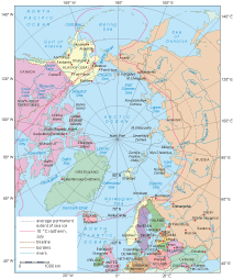
But both of these definitions – the treeline and the 10 °C July isotherm – are not boundaries that humans have marked, but ones that are dictated by environmental processes. In other words, they provide a natural definition.
Another way of mapping the Arctic region is to consider who lives there and where, as shown in Figure 15.
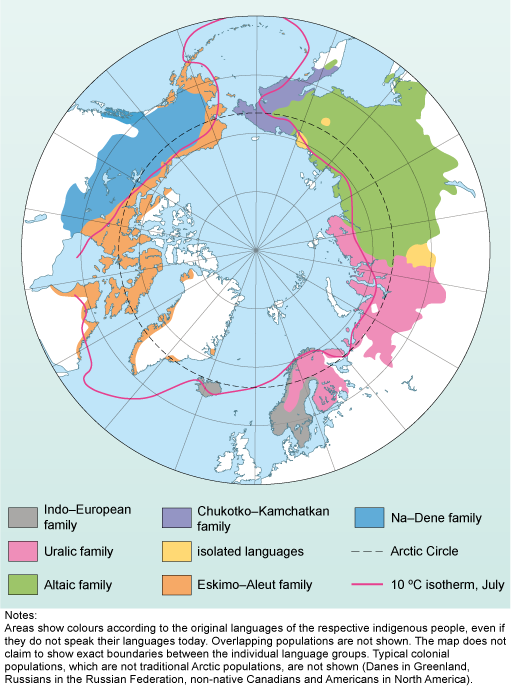
Based on the 10 °C July isotherm in Figure 15, how many different groups of indigenous peoples live in the Arctic?
There are at least six indigenous peoples living in the Arctic.
Arctic peoples are culturally diverse and the entire region has a population of ~4 million with many different languages. Because of this the Arctic will be defined through environmental boundaries of the 10 °C July isotherm or the treeline.