2.6 The surface
David A. Rothery Teach Yourself Planets, Chapter 6, pp. 66-75, Hodder Education, 2000, 2003.
Copyright © David Rothery
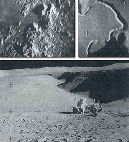
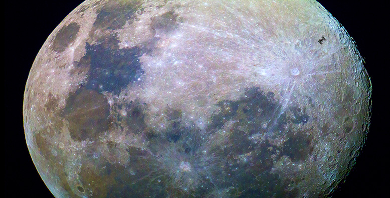
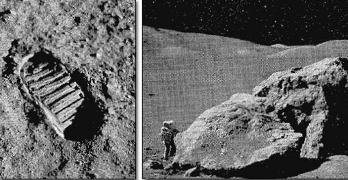
Look at the Moon even with the unaided eye, and you will see that it has dark patches on a paler background (Figure 2). This simple observation picks out the two distinct types of crust on the Moon. The paler areas are the lunar highlands, and the darker areas are the lunar 'seas' or maria (singular: mare). Both the highlands and the maria have very little bedrock exposed at the surface, because it is buried by several metres of regolith composed of ejecta from crater-forming impacts at all scales. In detail the regolith consists of a mixture of rock fragments, crystal fragments and droplets of glass (which are congealed globules of melt produced by impacts). This forms a 'soil' capable of bearing the imprint of a booted foot (Figure 3, left), but there are also scattered boulders of a variety of sizes (Figure 3, right).
The highlands are the first lunar crust to have formed, probably by crystals rising to the surface of the 'magma ocean' thought to have covered the young Moon as a result of the heat generated by collision of the Moon-forming fragments. Because of the preponderance of the mineral anorthite (a calcium-rich variety of the mineral plagioclase feldspar) this rock type is called anorthosite. The oldest anorthosite sample collected from the Moon has been dated at 4.5 billion years. However, most highland rock samples consist of fragments of rock that were welded together between about 4 and 3.8 billion years ago. These reflect the heavy bombardment suffered by the highland surface until the rate of impact cratering declined towards its current level.
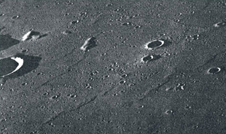
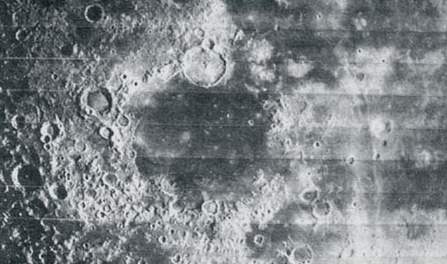
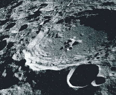
The high degree of cratering suffered by the highland crust is notable in the view seen in Figure 4. This also illustrates the dependence of crater morphology on crater size. Craters less than about 15 km across are simple bowl-shaped depressions with raised rims, but the largest crater in this view has the terraced inner walls and central peak that are characteristic of craters larger than this. At yet larger diameters the central peak is replaced by a ring of peaks, as in the crater in the lower right of Figure 1. The largest impact structures of all are multiringed impact basins (like Mercury's Caloris basin), dating from 4 to 3.8 billion years ago. The 2500 km diameter South Pole Aitken basin (Plate 2 [image can be found at nssdc.gsfc.nasa.gov/planetary/ice/ice_moon.html]) is the largest lunar example, but there are several others, one of which is now occupied by the Mare Humorum near the centre of Figure 2.
All the Moon's multiringed impact basins are older than the Moon's second kind of crust. This consists of basalt lava that has flooded low-lying areas to form the lunar maria. Many of the maria occupy multiringed impact basins, and it was once thought that the melting to produce the mare-filling basalts was a direct response to the basin-forming impacts. However, the ages of samples of mare basalt that have been returned to Earth range from 3.8 to 3.1 billion years old, so clearly the magma generation was triggered by unrelated events, and the magma ended up in the basins merely because it took advantage of the easiest routes to the surface. Inspection of detailed images of some mare areas that have not been sampled suggests that the mare-forming eruptions did not fully cease until about 1 billion years ago. The only extensive mare regions are on the lunar near side. Most of the far side features, even the South Pole Aitken basin, have escaped mare flooding, presumably because of the greater thickness of far side crust.
The mare basalts probably came into place as a series extensive lava flows, amounting to some hundreds of metres in total thickness. In some places, such as in Figure 5, the margins of individual lava flows can still be seen, and elsewhere there is spectacular evidence of the lava having flowed in tubes, which are revealed by later collapse of their roofs. A good example of this is seen in Figure 6, which shows Hadley Rille, the main focus of the Apollo 15 surface explorations. Most of the top left view shows the Apennine mountains, which are highland crust forming the rim of the Imbrium basin (a large near side multiringed impact basin). Hadley Rille emerges from an unseen source at the edge of the mountains, and snakes across the much flatter mare basalt terrain, appearing to have acted as a channelway that fed the later stages of mare flooding. It probably became roofed over by chilled and solidified lava, and this insulating cap enabled a vast quantity of lava to continue to flow through the tube without congealing. The rille is now visible because the roof of the tube collapsed at some time after it became drained of lava.