Part 2: Surveying
8. Bearing and distance
In this technique of surveying, you use the bearing (angle) and distance to each object. It is a useful technique if lots of features of the garden can be viewed from one place somewhere in the centre.
Bearing and distance process:
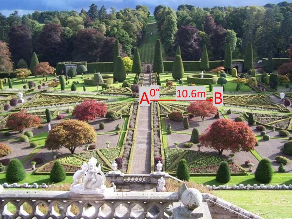
1. Set up a theodolite or dumpy level in the centre of the space (point A). Record one direction (a corner of a house or a significant feature) as 0°, this is point B. Record the distance from A to B.
Amber Crowley / public domain
2. Turning in a full circle record the bearing and distance for each feature that you would like to plot.
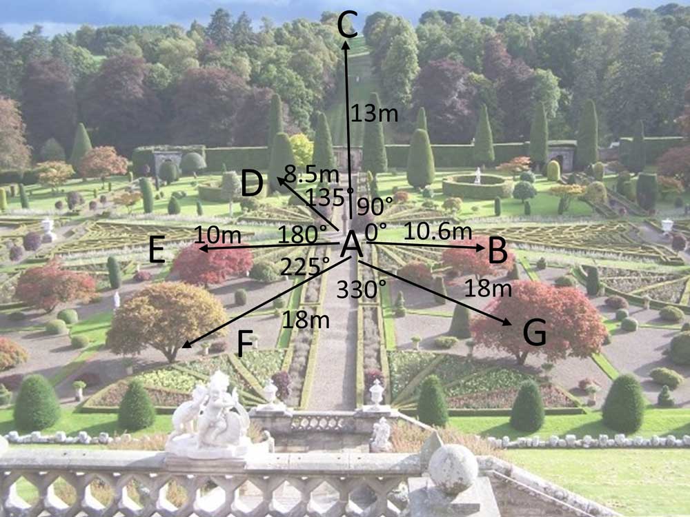
3. Using a protractor and ruler these can then be transferred to paper using a protractor and a scale ruler.
