Flooding is not new in the United Kingdom. The country has long experienced incidents of flooding around rivers and coastlines. However, there is now evidence that the country is experiencing more frequent and more intense flooding events, partially as a result of climate change. As with other coastal countries, the UK will face an increased risk of coastal flooding due to sea level rises and increased rainfall. The combined result of this will be increased erosion pressures on the coastline; increased rainfall will make cliffs softer and more prone to falls, while higher sea levels will also lead to enhanced erosion.
But how will this affect the Thames Gateway in southeast England?
To answer this question I visited the region with a film crew in 2008 to make a film for the Open University’s third level module on international environmental policy (DU311: Earth in Crisis). Over a few days we met with various people with a professional or personal interest in the relationship between climate change, flooding and coastal erosion. They included professionals working for the Environment Agency, Swale Borough Council and the Royal Society for the Protection of Birds, as well citizens whose homes and livelihoods are at risk from coastal erosion. The film we made examines the measures that are being taken in the Thames Gateway to plan for the problems of flooding and coastal erosion as a result of climate change.
Building defenses against flooding
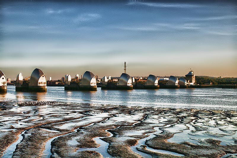
The UK is a more economically developed country than many of the countries that will be affected by climate change, such as Bangladesh. It is better placed to afford some of the large-scale engineering solutions, such as such as sea walls and river barriers that these countries cannot afford. The Thames Barrier was built following a tidal surge in 1953 caused by a combination of a high tide and unusually strong winds pushing water towards the land. The Barrier was not intended to protect against sea-level rises caused by climate change, but it will be used for this purpose during the early part of the twenty-first century. Towards the end of the century more substantial defenses will be necessary, if London and the surrounding area are to be protected.
One of the problems faced by those responsible for planning future sea defenses is scientific uncertainty. While it is clear that climate change will lead to sea level rises, the exact extent to which this will happen is not clear. The Environment Agency has estimated that by the year 2100 the best case scenario for the Thames Estuary is a sea level rise of about a metre, whereas the worst case scenario is an increase in sea level of 4.2 metres.
Managing the rising tide
To address the risks and outcomes of coastal erosion, the UK government’s Environment Agency has broken the coast down into a series of lengths, each of which is covered by a shoreline management plan (SMP). Different areas of shoreline may therefore be managed in very different ways. These management plans are interconnected, as how one area of coastline is managed may impact upon other areas. In the Thames Gateway the different SMPs are closely integrated so that the flood risk to London can be managed as effectively as possible. Three types of shoreline management plans are mentioned in the film:
Option 1: Hold the line
As its name suggests this strategy involves defending the existing coastline from erosion. This strategy may involve the building of sea walls along large areas of coastline. In the early days of coastal management hold the line was often the preferred policy in the UK. Now it is recognized that this policy is often prohibitively expensive, and in some case impossible to maintain over the long term.
Option 2: Managed retreat
The intention of this strategy is to manage the process of retreat while accepting that some coastal erosion is inevitable. Some areas may be allowed to flood, while others may be protected.
Option 3: No active intervention
This strategy involves allowing coastlines to erode and ‘letting nature take its course’, with the coast following its own natural erosion pattern.
Conclusions
Which strategy is pursued – hold the line, managed retreat or no active intervention - will depend on the estimated environmental and economic costs and benefits for the area of coastline in question. Building sea walls is more likely to make economic sense when more valuable land is being defended. In some areas a strategy of ‘no active intervention’ is followed, although, as is clear in the film, this is controversial, especially with local residents.
Climate change and sea level rise will impact upon different spaces in different ways over time. This will depend in part upon local physical geographies, such as soil and rock types, topography and the shape of the coastline. But it also depends in part on the economic power of the country involved. Wealthier countries, such as the United Kingdom, are more likely to be able to afford costly prevention and adaptation strategies compared to poorer countries, such as Bangladesh. Some states that are most vulnerable to climate change are sometimes those that have done least to cause the problem, such as the low lying Pacific island states.
Understanding the geographies of climate change and the different vulnerabilities of different countries thus requires an understanding not only of physical geography, but of the uneven distribution of political power and economic resources between and within countries. Today’s economic and political inequalities thus help to shape future vulnerabilities to environmental change.
If you are a student you can watch the film on the Environmental Studies Virtual Learning Environment, in an extended version of this article.

Rate and Review
Rate this article
Review this article
Log into OpenLearn to leave reviews and join in the conversation.
Article reviews