
Part 2: Surveying
9. Area levelling techniques
Levelling is the technique of determining one level of ground relative to another. Often a theodolite, dumpy or laser level is used but water levellers, string levels and spirit levels can be used in small spaces.
Process for taking levels with a theodolite, dumpy or laser level
1. Set up the level.
2. Put the measuring staff vertically at each point you want a measurement for and label the points A, B, C etc. To locate the points that have been measured a bearing and distance method or coordinates can be used.
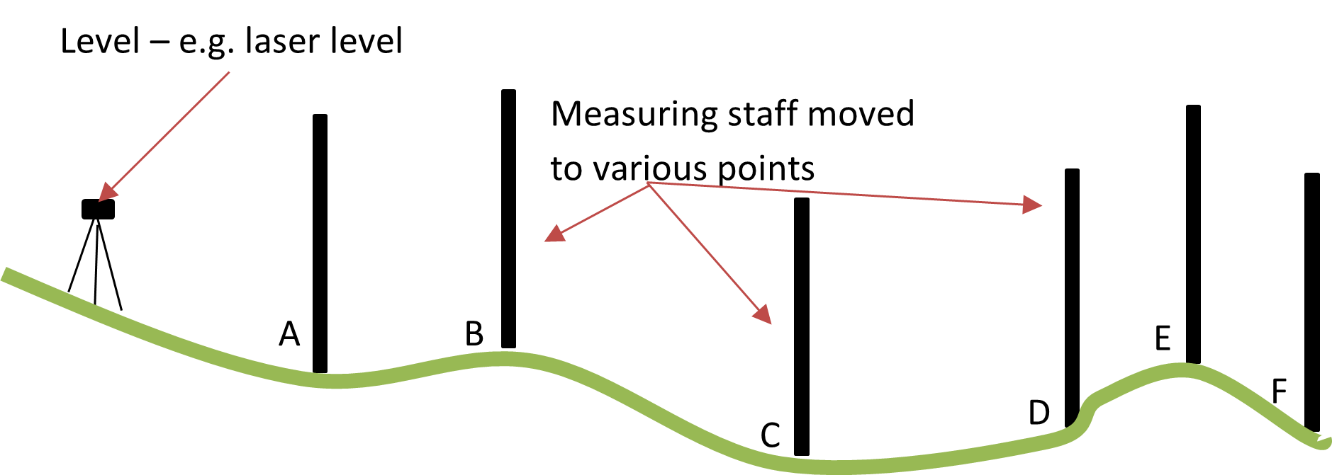
3. Read the level from the staff at each point it is placed.

4. Plot the slope into CAD software or onto graph paper.
Tip: Some mobile phones now have apps for surveying and although measurements should be checked for accuracy, they can give good results.
For more complicated landscapes it is sometimes worth hiring a specialist surveying company to do all this for you!
Go into a garden, it can be any garden at all, and have a think about how you would go about surveying it. Ask yourself these questions:
- Which survey technique would I use? (Linear, trilateration, triangulation, bearing and distance) or would I use a combination of techniques for this space?
- What information would go along with my measurements?
- What features are there?
- Which ones would I keep?
- Which areas are sunny and which are shady? How would this change through the day?
- What is the soil like?