

2 Farming in floodplains
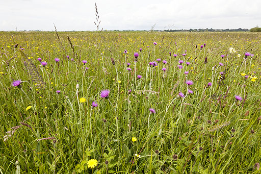
Floodplains have long been valued for their productivity. They are naturally fertile due to the deposition of nutrient-rich sediment during flood events. Nitrogen (N) and phosphorus (P) are key plant nutrients that are present in river sediments.
Floodplains are often ‘sub-irrigated’; water from the river moves laterally through the well-structured soils, meaning they can continue to support plant growth during drought conditions.
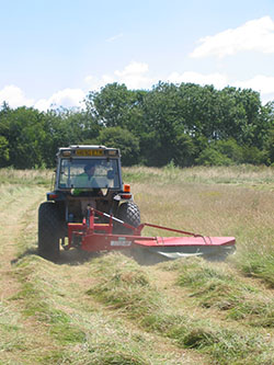
You can learn more about how nutrients move through the system to produce hay in Session 6.
At the current time, floodplains are primarily used for food production, with approximately 70% of floodplain land in England and Wales used for arable or intensively managed grassland (see Table 1).
| Land use | England* | Wales# | Total | |||
| extent | % cover | extent | % cover | extent | % cover | |
| Arable and horticulture | 2350 | 35.6 | 135 | 10.3 | 2485 | 31.4 |
| Improved grassland | 2200 | 33.3 | 655 | 50.2 | 2855 | 36.1 |
| Broadleaved, mixed and yew woodland | 450 | 6.8 | 135 | 10.3 | 585 | 7.4 |
| Coniferous woodland | 30 | 0.5 | 12 | 0.9 | 42 | 0.5 |
| Neutral grassland | 200 | 3.0 | 20 | 1.5 | 220 | 2.8 |
| Fen, marsh and swamp | 20 | 0.3 | 25 | 1.9 | 45 | 0.6 |
| Urban and suburban | 650 | 9.8 | 100 | 7.7 | 750 | 9.5 |
| Total floodplain | 6600 | 1305 | 7905 | |||
Footnotes
The land use categories are from the CEH Land Cover Map 2015. *Data from England is based on 2007 data, from Heritage & Entwistle, 2017. # Data from Wales, unpublished data, Floodplain Meadow Partnership.However, increased uncertainty of flooding makes tilling floodplain land for crops difficult, and there is a risk that land will be lost from food production altogether, damaging our food security. Climate models predict flood events will become more frequent with time, making some land uses unsustainable. Experience in Somerset, where prolonged deep flooding during the winter of 2013–14 led to extensive grass kill on re-seeded ryegrass leys, contrasted with traditional floodplain-meadow plant communities of RSPB’s West Sedgemoor nature reserve, which recovered to good condition within a matter of weeks after the floods had receded (Natural England et al., 2014).
Can we farm in floodplains to produce food while simultaneously protecting and enhancing natural resources?