

2.23 Mineral maps
The following activity uses a geological and elemental map of Anglesey and North Wales, covering the area of Parys Mountain and Great Orme.
This map will give you the opportunity to see the concentrations of copper, found in streams and sediment samples. The data has been collected by the British Geological Survey. Most countries have their own geological surveys, so if you are interested in the geology near you and you live outside the UK, you may want to have a look online and see what data is available for where you live.
Activity _unit2.24.1 Activity 2.7 Anglesey and North Wales
Part 1
Look at the map. It shows the rocks divided up into igneous (pink), sedimentary (blue) and metamorphic (green). The symbols show the concentrations of copper, lead and zinc found in streams and river samples.
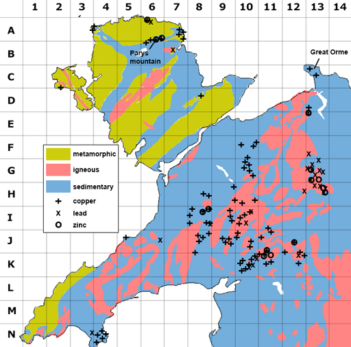
The area covered by Parys Mountain mines is only 3 km2, but on the map the area with high copper concentrations is much larger? Why is this?
Do the different mine types correspond to any particular rock type?
a.
6 A
b.
6 B
c.
13 C
d.
10 F
The correct answers are a and b.
a.
Zinc
b.
Lithium
c.
Copper
d.
Aluminium
The correct answers are a and c.