2 Taking Earth’s temperature
Taking Earth’s temperature is an important measurement for climate science. But how is it possible to take the temperature of an entire planet like the Earth?
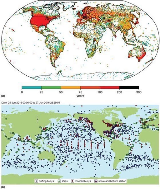
Weather over land is observed by ~11 000 weather stations dotted around the planet (Figure 3a). The vast majority are at ground level, while some are mounted on weather balloons and aircraft. Over the oceans, weather data are collected by ships, buoys and fixed stations on islands and platforms such as oil rigs.
Figure 3b shows a snapshot of locations measuring sea surface temperature. Since the late twentieth century, we have also had technologies watching the planet from space: satellites. These ‘Earth Observation’ satellites can measure a variety of aspects of the Earth system, including upper air temperature (tens of kilometres above the ground) and sea surface temperature.

-
Looking at Figure 3a, which three regions of the world’s land have the poorest coverage of weather stations?
-
Greenland, North Africa and Antarctica.
-
Name two characteristics of areas where land stations tend to be located.
-
They tend to be located in areas of higher population and in more developed countries.
If humans have been taking the Earth’s temperature for many years, are we seeing a shift in global temperature?
