4.2.1 Distribution of fresh water in Ethiopia
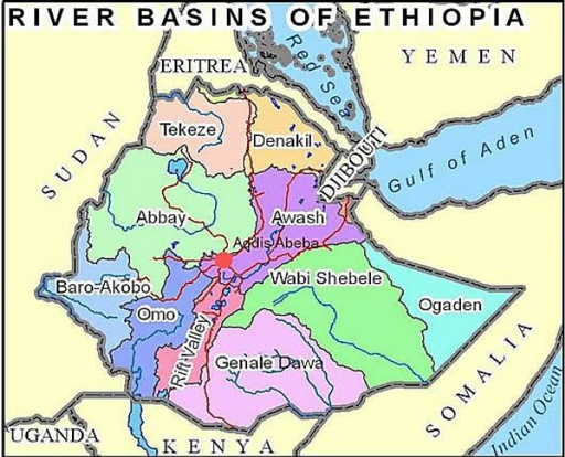
In Ethiopia, there are 12 major river basins/valleys, 11 lakes, 9 saline lakes, 4 crater lakes and more than 12 major swamps (Mekiso, n.d.). The average annual flow of water from all the 12 river basins is estimated to be 123.25 billion m3 (Figure 4.3). Several of the major rivers cross to neighbouring countries. For example, the Abbay River flows to Sudan and Egypt, and the Omo to Kenya. It has been estimated that 95% of Ethiopia’s annual run-off flows out of the country in these cross-boundary rivers (Waterwiki, n.d.).
In Ethiopia, it is estimated that 54.4 billion m3 of surface run-off and 2.6 billion m3 of groundwater could be developed for use by people. However, the amount of rainfall, river flow and groundwater is highly variable across the country and depends on location and altitude. Some areas have sufficient water, while others don’t have enough. Figure 4.4 shows maps of rainfall and groundwater availability during drought in Ethiopia. Most permanent springs and streams exist only in the highlands in the west of the country. In areas below 1500 m above sea level, which is more than 55% of the country, there is hardly any surface run-off and very few permanent springs and streams.
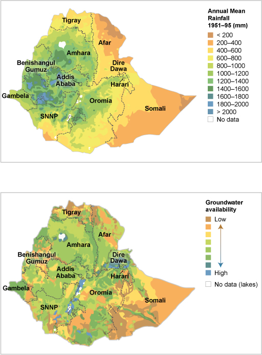
Based on the two maps in Figure 4.4, which regions of Ethiopia have the least available water?
Somali and Afar regions have the lowest mean annual rainfall in the country. Somali also has very little available groundwater. Afar has relatively high groundwater availability.
The availability of water resources is also uneven over the year. At some times of the year you might have too much water, leading to flooding. At other times there may not be enough water, leading to drought.
4.2 Distribution of water resources