2.3 Europa’s surface
Before spacecraft were sent to Europa, spectroscopic measurements revealed that its surface is mainly water-ice. As it is so small and so far away from the Sun, it was expected that Europa would be like a frozen snowball orbiting Jupiter and so would be a completely inactive world densely peppered by impact craters. This idea was changed when uncrewed spacecraft were sent to the Jupiter system.
Take a look at this gallery. It contains images taken by the Voyager and Galileo spacecraft and reveals how these observations transformed our view of the moons of the outer Solar System.
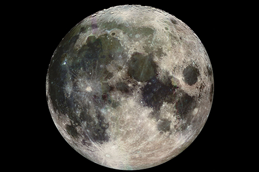
Earth’s Moon is rocky (Figure 19), with a low albedo (it reflects only 14% of the sunlight falling on it).
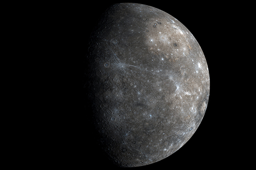
The planet Mercury (Figure 20) is not much larger than our Moon and has a similar highly cratered surface, though most of it was originally volcanic. Craters are most easily seen near the terminator (the day–night boundary, on the left), where they are emphasised by shadows.
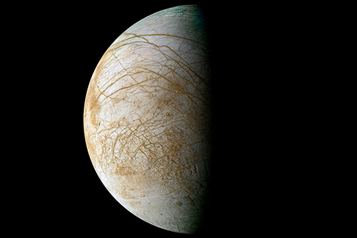
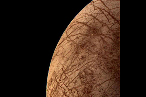
Europa’s surface (Figure 21) has a much higher albedo than either the Moon’s surface or Mercury’s, but this is not apparent from individual images because each has been separately processed. (You may recall that the albedo of an object is the percentage of the incident light that it reflects.) However, you will make out few, if any, craters on this image.
The Voyager 1 and 2 spacecraft flew past Jupiter in 1979 and sent back our first pictures of Europa’s smooth, bright surface, with barely any craters but mysterious dark fractures across its surface.
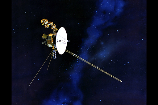
Figure 23 is of Europa taken by Voyager 2 at its closest approach. The lack of impact craters was surprising. This, along with the smooth, low topography suggests a much younger surface than Jupiter’s other large icy satellites Ganymede and Callisto, where the scars of large, ancient impact craters dominate the landscape. From images like this, it was concluded that Europa’s surface had been recently renewed, possibly by processes that are still taking place.
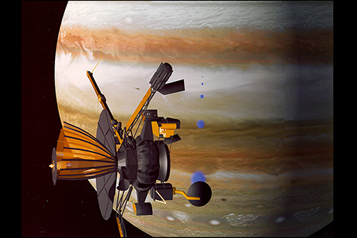
This artist’s impression (Figure 24) shows that Galileo’s orange parabolic high-gain antenna had failed to open correctly, rendering it useless for radio communication. All Galileo’s data had to be sent back Earth using a less powerful low-gain antenna.
Europa is covered in ridges of various sizes that rise above the surface. It is thought that these ridges represent areas where liquid water has risen to the surface through cracks as they open, and has then been squeezed out as freezing slush as the cracks have closed. Most cracks are probably sealed shut, but a few could open and close tidally, perhaps twice during Europa’s 3.6-day orbit. The ridge pattern is sometimes described as ‘ball-of-string’ terrain (Figure 25), because it makes Europa look like a giant ball of string. The area shown is 14 km by 17 km.
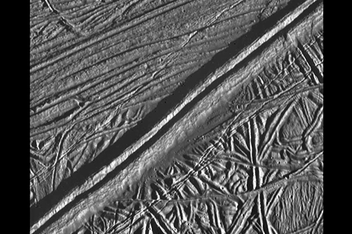
On Europa ridges can be seen crossing over one another, suggesting that the crust has undergone many episodes and directions of faulting and movement in response to internal heating. The ridged (‘ball-of-string’) surface appears to have been partly broken apart on the right in Figure 26. The three black sideways bands are gaps in the data, rather than features on the surface. The image covers an area of 108 km by 90 km.
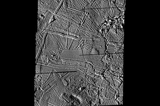
Figure 27 shows a so-called chaos region on Europa. There are ice rafts containing ridged surfaces, which appear to have drifted apart before becoming refrozen in place. This resembles ‘pack ice’ in the Earth’s polar oceans. The area between the ice rafts that is lacking in ridges is referred to as ‘matrix’. The image is about 45 km across.
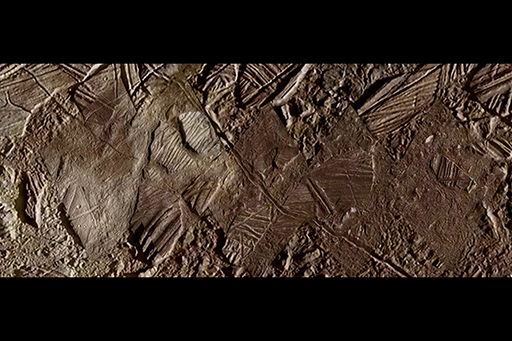
Figure 28 is another image of a ball-of-string surface, disrupted into small patches of chaos terrain and with a few domes possibly overlying upwellings from below. The area shown is 140 km by 130 km.
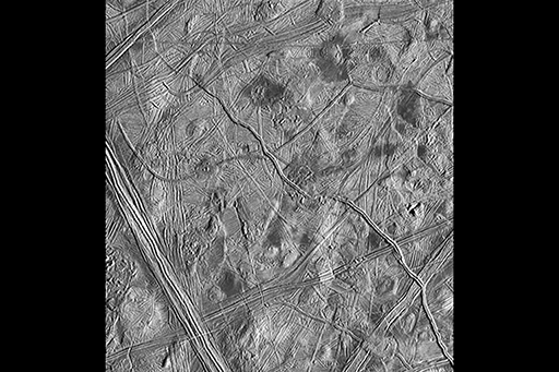
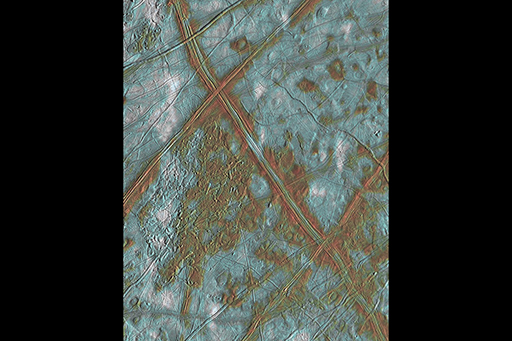
Figure 29 is a 200 km by 250 km area of Europa, where the icy surface has been cracked and broken apart many times. Most of the ice shows as blue. The red colouring beside some of the largest ridges and in some small regions of chaos is thought to be caused by salt or clay impurities. White patches are dustings of ejecta distributed from an impact crater 1000 km further south.