
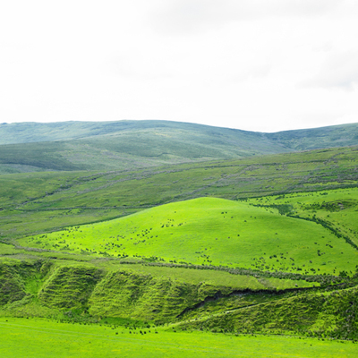
 Sperrin Mountains in County Tyrone, Northern Ireland
Northern Ireland rocks
For a small area Northern Ireland has exceptional geological diversity. A geological column is a table summary of all the rock ages in years; 'era' is a large block of earth history; 'periods' are based on timings of particular geological events (often ending at mass extinctions); and it also shows the environment of deposition.
This geological map shows where these rocks can be found throughout Northern Ireland.
The oldest rocks in Northern Ireland are metamorphosed sedimentary rocks and can be seen in Donegal, Derry and Tyrone. They were deposited in an ancient Iapetus ocean, which formed about 600 million years ago.
When this ocean began to close, a large mountain range formed the size of the modern Himalaya. As continents collided, they formed the Caledonian mountain range that stretched through present day Scotland, Scandanavia, North America and, of course, Northern Ireland. The granites of South Armagh and the marine sediments of Down to Armagh were all part of this great collision. Remnants of these mountains are found in the present day Sperrin Mountains of Tyrone.
Semi-arid conditions prevailed and the mountains were eroded to form Devonian sandstones (marked as brown on the map) that can give reddish soils in parts of County Tyrone today.
The Carboniferous period of Earth history records rising and falling sea levels. During this time Ireland was located close to the equator and the warm shallow seas led to the formation of limestone rocks that were filled with fossilised reef deposits containing corals, crinoids and brackiopods. These are visible in most of the Carboniferous limestones throughout County Fermanagh. Sometimes, when sea levels swamped low-lying lands, coals formed and this is why the period is called Carboniferous as a lot of carbon was preserved at this time and in these swamps.
After the Carboniferous, in the Permian and Triassic times, dry conditions prevailed with more desert deposits and hypersaline lakes forming as seen in the salt deposits near Carrickfergus, County Antrim.
Sea levels rose again in the Jurassic period with shallow seas containing ammonites recorded in Larne.
During the Cretaceous period, warm shallow seas lead to widespread formation of chalk created by the shells of tiny sea creatures called coccolithophores and can be seen on the north coast of Co. Antrim.
Intense volcanic activity occurred during the Palaeogene and Neogene times as the modern Atlantic ocean began to form, and this resulted in the extrusion of lava into the shallow chalk seas, leading to the formation of the Giant’s Causeway.
The Quaternary period (2 million years ago) is marked by glaciations and during this period all but the highest points of Ireland were covered by ice sheets. The ice sculpted the older bedrock and has led to most of the landscape features we see today. Drumlins formed beneath the ice and glacial valleys were cut into the rock.
Within the last 10,000 years warming has occurred allowing for Ireland to be colonised by plants, which culminated in forests across the country.
The geology of County Fermanagh, Northern Ireland
The next oldest rocks in Fermanagh are the Devonian sandstones that are on the East of Lough Erne, formed by rivers in a desert-like landscape between 410 and 354 million years ago.
After this, the sea levels began to rise, beach sands were lain down and, as the seas got a little deeper, limestones were formed. At this time Ireland was close to the equator and reefs formed, which contained lots of animals such as corals, brackiopods (lamp shells because they are the shape of Roman lamps), and crinoids which are sea lilies. Over 80 brachiopod and 65 bryozoan (sea mat) species have been identified at one location. These fossils can all be seen in the Carboniferous limestones across Ireland and they also help us identify the age of the rock as different types of fossils lived at different times in Earth history. The Carboniferous period lasted from approximately 354 to 298 million years ago and most of Fermanagh contains limestones from this period and they are marked in blue on the geological map.
The youngest solid rocks found in the county are dark volcanic rocks that were intruded into fractures in the Earth's crust around 60 million years ago.
Extensive cave systems have developed in the limestones of which the Marble Arch Caves are best known. They developed at the end of the Ice Age when melt water dissolved away the stone. As it did so, it also precipitated out calcium carbonate to form stalactites and stalagmites and other beautiful formations.
Biodiversity of Fermanagh
Fermanagh’s varied landscape provides a unique biodiversity and supports 50% of Northern Ireland's 'Priority Habitats' and approximately 23% of 'Priority Species'.
Fermanagh wetlands support a range of different habitats including Fens that support rare plant species, such as fen bedstraw, Irish lady’s tresses orchid and the regionally rare Irish damselfly. It is also the only site in Northern Ireland where the ground beetles Carabus clatratus can be found.
Lakes and their islands are important for bird species and 40 islands are managed by the RSPB. Lough Melvin is particularly noteworthy for brown trout and the red listed species Arctic charr. Rivers and streams support otter, freshwater pearl mussel, salmon, trout and white-clawed crayfish, reed bunting and reed-beetle.
The abundance of limestone pavement creates a unique calcareous habitat in the exposed rocks with the characteristic blocks (clints), and fissures (grykes) support wild thyme, blue-moor grass and juniper. Calcareous grasslands support unique species such as the Irish eyebright and the small blue butterfly. Turlough are lakes that dry out in summer when the water level are below ground. They support distinctive plants such as the white water-lily and bog bean.
The very wet climate and the thin soils on the uplands of Co. Fermanagh create the perfect conditions for Blanket bogs, which support bilberry and woolly-hair moss and species such as golden plover, hen harrier, red grouse, curlew, skylark and the Irish hare. Upland heathland has a peat covering of less than 50cm in depth. Wet heath is most common and contains cross-leafed heath, purple moor-grass and Sphagnum mosses. Dry heath contains bell heather, bilberry and crowberry. It is the only known location for rare slender thread-moss. Bogs have long provided fuel for the rural people in Ireland and are now severely threatened due mechanised turf cutting.
Woodland is characterised by the presence of sessile oak (also known as the Irish Oak), pedunculate oak and downy birch with smaller trees of rowan, holly and hazel - the latter two being used extensively for basket making in the past. Fermanagh woodlands also support particularly rare plant species, such as the serrated wintergreen and Tunbridge filmy-fern. The hugely popular red squirrel is found there along with the very secretive pine marten.
Hedgerows have huge cultural significance in Irish heritage as they were planted to define townland and parish boundaries and to demark agricultural fields. Species-rich hedgerows contain five or more native woody species within 30m length are extremely important habitats for biodiversity. Native hedgerow trees are hawthorn, blackthorn, gorse, holly, willow, hazel and birch and they support hundreds of species including linnet, bullfinch, song trush and dunnock and mammals such as the stoat, Irish hare and hedgehog.
Find out more about Fermanagh: The backdrop to the G8 summit.
Try a free OpenLearn course on Geological processes in the British Isles.
Rate and Review
Rate this article
Review this article
Log into OpenLearn to leave reviews and join in the conversation.
Article reviews