Skip to content
Skip to main content

About this free course

Download this course

Share this free course

What do historians do?

Start this free course now. Just create an account and sign in. Enrol and complete the course for a free statement of participation or digital badge if available.

A manuscript map. The map is divided into several colour-coded areas. Some areas have drawings of trees, but most do not. Each area is labelled, corresponding to the place names listed in the figure description.
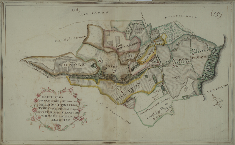
Figure 5 Map by Charles Ross, showing South Port Toumnahurich, Shigartan, Hillhouse, Tyna Crove, Tyinloine, Miln of Finlays, Ross Finlays, Shantron, Shimore, Shibeg, Blaruile. It comes from a one of a series of books of estate maps of lands on the western shores of Loch Lomond. This map was published in A Book of Maps of the Estate of Luss belonging to Sir James Colquhoun Baronet surveyed & planed by Charles Ross (1776).

 1.2 Land management