

4.1.3 Global positioning system (GPS)
Your phone is likely to use global positioning system (GPS) software to track your location for maps and other apps. Receivers are also made for aircraft, ships, ground vehicles and as hand-held devices.
Examples of applications for GPS are:
- navigation
- surveying, and establishing the shortest distance between two points (a line of sight along the ground is no longer necessary for precise positioning, so greater distances, with features such as hills obscuring the line of sight, can be surveyed much more easily)
- plate tectonic studies (seeing how large areas of the earth’s surface move relative to each other).
The worldwide GPS is funded and controlled by the US Department of Defense (DOD) but its standard positioning service is used by many thousands of civilian users worldwide. More expensive receivers, such as those used in aircraft, are more accurate than the standard service used by most recreational receivers.
The system involves a network of satellites in orbit around the earth, which provide specially coded signals that can be processed in a GPS receiver. Signals from four GPS satellites enable the computer in the receiver to compute the receiver’s position in three physical dimensions (i.e. latitude, longitude and altitude), the receiver’s velocity, and a highly accurate time.
The satellite system for GPS
The GPS satellite system consists of at least 24 satellites in orbit at any one time. The placement of the satellites is such that a user’s ground-based receiver can receive signals from between five and eight satellites from any point on the earth’s surface. Satellite orbits are calculated and controlled from a series of ground stations, one of which (in Colorado in the US) is the master station.
Most leisure users of GPS receivers want to relate position, and perhaps movement, to particular places and features in the landscape. It may be no use to a hiker (trying to get to the next refuge) to come to the foot of a high cliff believing that she’s travelling in the right direction; she needs to know the cliff is in the way of her direct line of travel. This is where the geographical data that goes into making maps comes into its own.
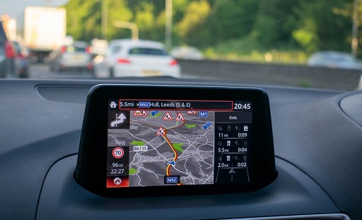
Most GPS systems allow users to superimpose their position information onto a map created from a collection of geographical data that can be loaded into the GPS receiver. As the user moves through an area, the map is constantly updated, keeping the user at the centre of the map. What transforms the data into a map which can be understood (i.e. information) is a small computer contained within the receiver device.
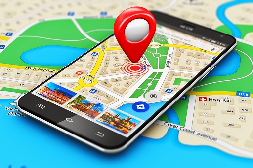
Figure 12 shows an example of a GPS receiver, and how the receiver’s position is ‘placed’ at the centre of the map, indicating the current position and direction of the carrier.
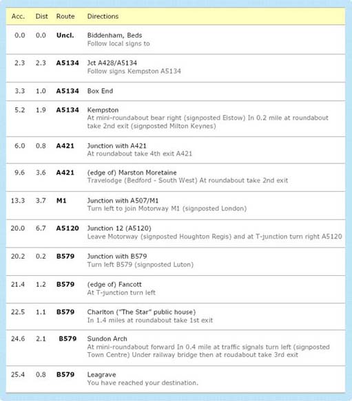
What happens when a map is wholly inappropriate, e.g. when navigating in the dark, smoke or fog, or if the user has a visual impairment? In such situations oral directions are needed, meaning spoken words to describe both surroundings and the ‘features’ of a journey (left, right, straight ahead, crossroads, junction, and so on). Many navigation devices can give audible directions as an alternative/supplement to a map: ‘Proceed straight ahead for 100 metres before turning left 90 degrees into Porchester Road …’.
Such devices are being further developed as hand-held aids for:
- those with a visual impairment to navigate campuses, shopping malls and buildings
- members of the emergency services who may have to find their way around an unfamiliar building quickly in thick smoke and darkness, or district nurses trying to navigate to a patient, or emergency mountain rescue teams tracking to an individual who is lost.
Since, in the case of buildings, GPS signals don’t work to a small enough scale and don’t penetrate into such structures, they can be supplemented by small local signal beacons or even bar codes on doors and in corridors.
Developments in this area (e.g. Google Maps, and built-in navigation in cars) result in ever more accurate directions to help us navigate.
Just think of the importance of managing a patient caseload for a health visitor who can plan using satnav, ensuring that the patient will have a reasonable expectation of when they will arrive, and the healthcare professional being able to maximise their effort to meet that caseload need.
Here are some further examples of how a computer system can use the right sort of data to generate useful information in an appropriate way:
- A computer in a microwave oven transforms the pulses of an electronic clock into a time display that shows how long until the cooking is finished.
- A computer in a satellite television control box obtains the signals emitted by a transmitter satellite and converts them into a television picture and sound for the attached television set.
- The computers in a nuclear power station monitor signals produced by pressure sensors and other devices to provide a moment-by-moment summary of the state of the reactor.
- A computer in a car turns the pressure of the driver’s foot on the brake pedal into fine control movements of each wheel’s brake so as to prevent the car from skidding.
- A powerful PC turns signals from a scanner into a representation on the computer’s screen of the item scanned. The PC can then accept commands from the user to modify that image.
It is transformations like these that lie at the heart of this course.
Activity 10 Healthcare data
Consider a computer on a ward.
- 1. What kinds of data might it require and where would these originate?
- 2. What kinds of information might it present to the healthcare team?
Discussion
- The data originates either from a variety of sources, observational (looking at the patient), devices (thermometer, BP machine), data on the computer screen (labs, radiology), paper based records..
- The observation chart might display the patients obs, and perhaps a change. The computer screen might display the patient record. Notes will provide a record over time of the patient’s treatment and response.
Activity 11 Data, information and parameters
- 1. What is the role of the computer with respect to the data given to it?
- 2. How should requirements (such as the need for a user’s attention to be focused on a complex task like driving) affect the presentation of information?
- 3. What, in your own words, is the meaning of the term parameter?
Discussion
- The role of the computer is to transform data into information.
- The presentation of information needs to be fit-for-purpose and, in the example given, presented in a way that lets the user keep their primary focus of attention on the task.
- A parameter is a property or characteristic of something that is measurable or quantifiable.