
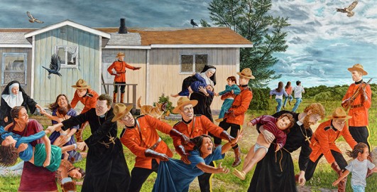
1.2 Indigenous mapping
In Figure 2, you see a map of Sábmi. You might not be able to place this region at first glance, but if you look closely, you may recognise the contours of Scandinavia. Sábmi, or Sápmi, is the land inhabited by the Sámi people, stretching today across Norway, Sweden, Finland, and Russia.
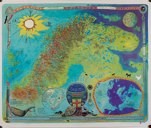
This map was created by Sámi artist Keviselie (also known by his Sámi name Elle Hánsa and Norwegian name Hans Ragnar Mathisen), celebrated for his cartographic artworks. Keviselie’s map is not divided by the national borders and is filled with Sámi place names.
Sámi anthropologist Marit Myrvoll (2017, p. 107) notes how maps have been more effective tools of colonisation than weapons, commenting on the way many Sámi place names were lost by the turn of the twentieth century.
Activity 3 Putting Sápmi on the map
You will now listen to an excerpt from a podcast interview with Keviselie about the process of making the first map of Sápmi:
Transcript: Audio 1: Putting Sápmi on the Map
After listening to the excerpt, answer the following questions:
a.
Because plastic sheets had lower production costs.
b.
Because Keviselie wanted the map to appear more modern.
c.
Because the plastic sheets were easy to copy, making the map widely accessible rather than exclusive.
d.
Because plastic sheets made the map waterproof.
The correct answer is c.
a.
It challenges established maps made from a colonial non-Sámi gaze.
b.
The inclusion of Sámi place names reclaims a sense of connection and belonging to the land that colonial mapping erased.
c.
It is a primarily an artwork rather than a functional map.
d.
By removing national borders, the map challenges divisions imposed by nation-states.
The correct answers are a, b and d.
a.
Sámi language(s)
b.
Sámi knowledge(s)
c.
Sámi people(s)
d.
Homeland of the Sámi people(s)
The correct answers are a, c and d.