

Image bank
This is Watching the weather's image bank. If you want to return to the unit, please click here.
record 19 of 38
| image title | Visible image from Meteosat SEVIRI |
| image |  |
| caption | A visible image taken from the geostationary satellite Meteosat SEVIRI (placed over the Greenwich Meridian, longitude 0°) at 1200 UTC on 2 May 2008. The outlines of countries are overlaid and there is also a grid of reference marks (+). This image is illuminated by sunlight and the brightness indicates the amount of light that has been scattered back to the satellite; clouds appear white and the oceans (where cloud-free) appear darker than the land. Strong convective cloud activity can be seen in equatorial regions, whereas at mid- and high latitudes clouds indicate the presence of large high- and low-pressure systems and frontal structures; a good example is a weather system over the South Atlantic. |
| code | MI019 |
| Section | Meteorological instruments |
| Subsection | Satellites |
| image credit | © 2007 EUMETSAT |
| thumbnail | 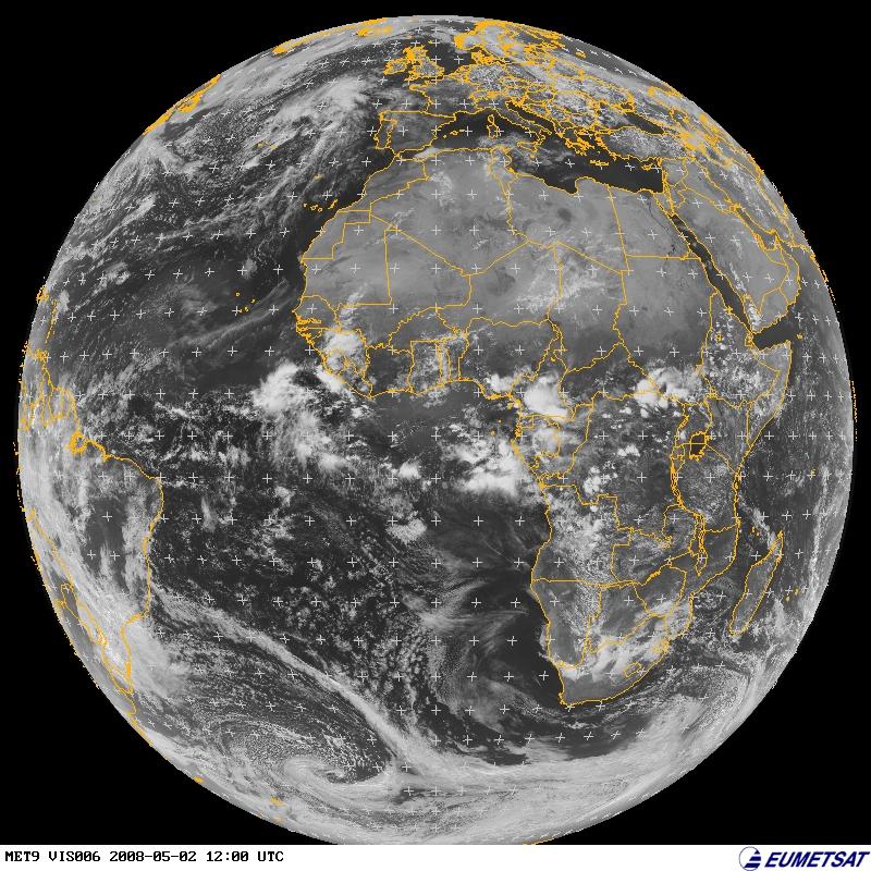 |
| File | |