

Image bank
This is Watching the weather's image bank. If you want to return to the unit, please click here.
record 20 of 38
| image title | Infrared image from Meteosat SEVIRI |
| image |  |
| caption | Greenwich Meridian, longitude 0°) at 1200 UTC on 2 May 2008. The outlines of countries are overlaid and there is also a grid of reference marks (+). Over the disk of the Earth, lighter colours have been used to indicate colder temperatures, as is conventional in IR images. In this image, in contrast to those in the S189 course book and others on this DVD, space around the Earth has been re-coloured black to produce a more natural looking image; space is, of course, the coldest, and not the hottest part of the image as the black colour might otherwise imply. The surface of north Africa, where it is mid-day, is the hottest (darkest) region visible and is clearly warmer than the oceans. Equatorial convective cloud-tops are high and therefore cold and coloured white. Mid-latitude cloud-tops tend to be a little lower and are a slightly darker grey. |
| code | MI021 |
| Section | Meteorological instruments |
| Subsection | Satellites |
| image credit | © 2007 EUMETSAT |
| thumbnail | 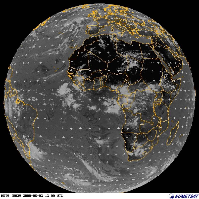 |
| File | |