

Image bank
This is Watching the weather's image bank. If you want to return to the unit, please click here.
record 21 of 38
| image title | Water vapour image from Meteosat SEVIRI |
| image | 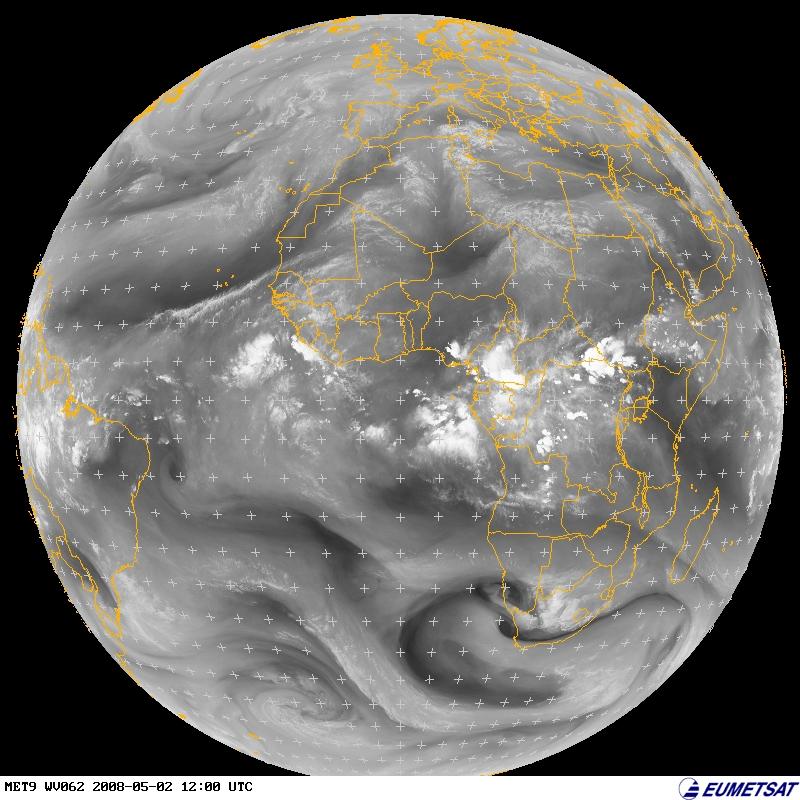 |
| caption | Greenwich Meridian, longitude 0°) at 1200 UTC on 2 May 2008. The outlines of countries are overlaid and there is also a grid of reference marks (+). This image is taken in the infrared at a frequency particularly sensitive to water vapour. Light colours indicate greater amounts of water vapour and this is particularly clear in equatorial convective systems. Regions of moist (light) and dry (dark) air are also associated with the mid-latitude weather systems and there is significant water vapour even in regions which are cloud-free in the visible and infrared images, for example over north Africa. |
| code | MI023 |
| Section | Meteorological instruments |
| Subsection | Satellites |
| image credit | © 2007 EUMETSAT |
| thumbnail |  |
| File | |