

Image bank
This is Watching the weather's image bank. If you want to return to the unit, please click here.
record 22 of 38
| image title | Water vapour image from GOES East |
| image |  |
| caption | A water vapour image taken from the geostationary satellite GOES East (placed over the east coast of America, longitude 75° W) at 1200 UTC on 20 August 2007. The outlines of countries are overlaid and there is also a grid of reference marks (+). This image is taken in the infrared at a frequency particularly sensitive to water vapour. Light colours indicate greater amounts of water vapour and this is particularly clear around Hurricane Dean. Regions of moist (light) and dry (dark) air are also associated with the mid-latitude weather systems. |
| code | MI029 |
| Section | Meteorological instruments |
| Subsection | Satellites |
| image credit | © 2007 EUMETSAT |
| thumbnail | 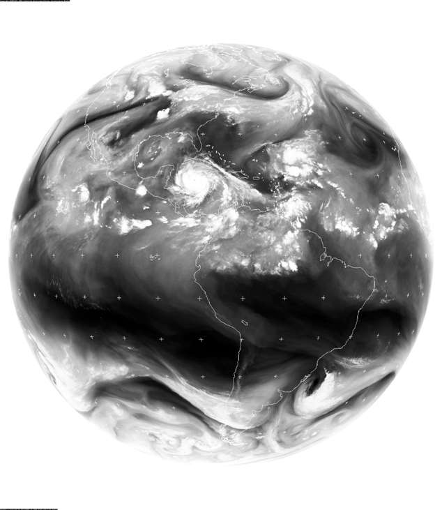 |
| File | |