

Image bank
This is Watching the weather's image bank. If you want to return to the unit, please click here.
record 23 of 38
| image title | Visible image from Aqua polar-orbiting satellite |
| image | 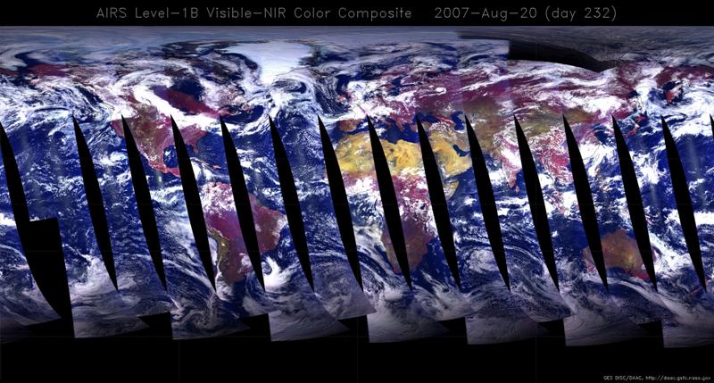 |
| caption | A mosaic of visible images taken by the Atmospheric InfraRed Sounder (AIRS) from a polar-orbiting NASA satellite, Aqua, on 20 August 2007. Aqua has been placed in a 705 km altitude, 99 minute period orbit, which passes within 10° of the poles. On each orbit, the satellite crosses the Equator when the local time beneath it is 1:30pm on the day-side and 1:30am on the night side. The images have been taken at several different frequencies to reconstruct an approximately natural colour image. All the images have been projected onto a regular latitude-longitude map and the continents are clearly visible. Each nearly vertical stripe which makes up the full image was taken on the day-side of the Earth on a successive orbit in the same 24-hour period. The date of the image was chosen to match the geostationary images from GOES East (MI025, 027, 029) for comparison; part of Hurricane Dean is seen in one stripe, but the visible images do not quite overlap at low latitudes and so the rest of it is not seen. On the other hand, high-latitude features are better resolved than in the geostationary satellite images. |
| code | MI031 |
| Section | Meteorological instruments |
| Subsection | Satellites |
| image credit | © NASA |
| thumbnail |  |
| File | |