

Image bank
This is Watching the weather's image bank. If you want to return to the unit, please click here.
record 30 of 38
| image title | Radar detection of precipitation |
| image |  |
| caption | This image shows a composite precipitation image from weather radar networks in the Nordic region of Europe. The overlapping circular areas correspond to the coverage of individual stations (this is often called their 'footprint'). There are 30 weather radar stations in Norway, Sweden, Denmark, Finland and Estonia and data sharing among them generates a composite image in real time, which is updated every two hours. Notice the colour scale that shows the intensity of the precipitation. |
| code | MI038 |
| Section | Meteorological instruments |
| Subsection | Balloons, aircraft and radar |
| image credit | courtesy Swedish Meteorological and Hydrological Institute |
| thumbnail | 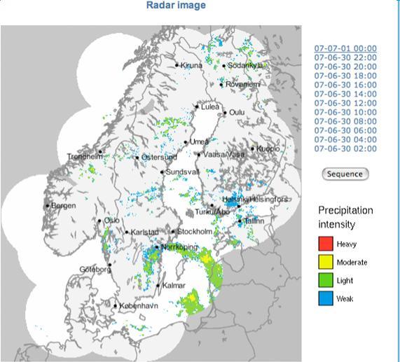 |
| File | |