

Image bank
This is Watching the weather's image bank. If you want to return to the unit, please click here.
record 31 of 38
| image title | 3-day sequence of visible images from Meteosat SEVIRI |
| image |  |
| caption | A sequence of visible images taken from the geostationary satellite Meteosat SEVIRI (placed over the Greenwich Meridian, longitude 0°) once every three hours over a period of three days from 1800 UTC on 29 April 2008 onwards. Mid-latitude weather systems can be seen to move predominantly from west to east and the growth of convective cloud activity in equatorial regions is clear around mid-day and into the afternoon (roughly 1200-1800 UTC if looking at the centre of the image). Since the satellite is placed over the Greenwich meridian, the UTC corresponds to local time of day directly below the satellite. A grey globe is shown in frames when there is no visible image available, normally at 0000 UTC, when the Sun is on the opposite side of the Earth to the satellite and there is no illumination at visible frequencies. |
| code | MI020 |
| Section | Meteorological instruments |
| Subsection | Satellites |
| image credit | © 2007 EUMETSAT |
| thumbnail | 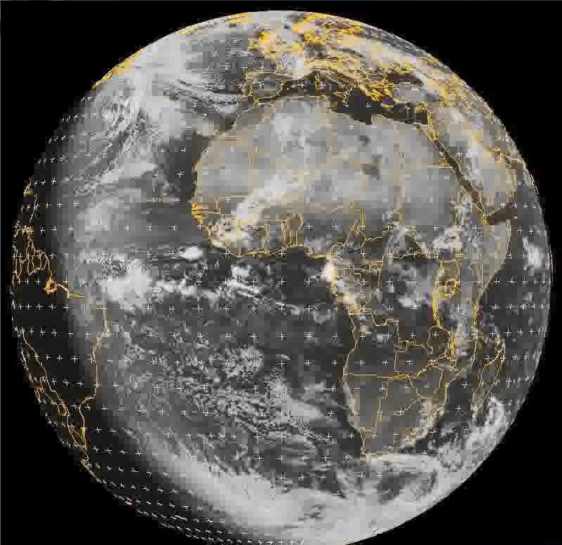 |
| File | 02-MSG2-VIS-new.flv |