

Image bank
This is Watching the weather's image bank. If you want to return to the unit, please click here.
record 36 of 38
| image title | Visible image from GOES East |
| image | 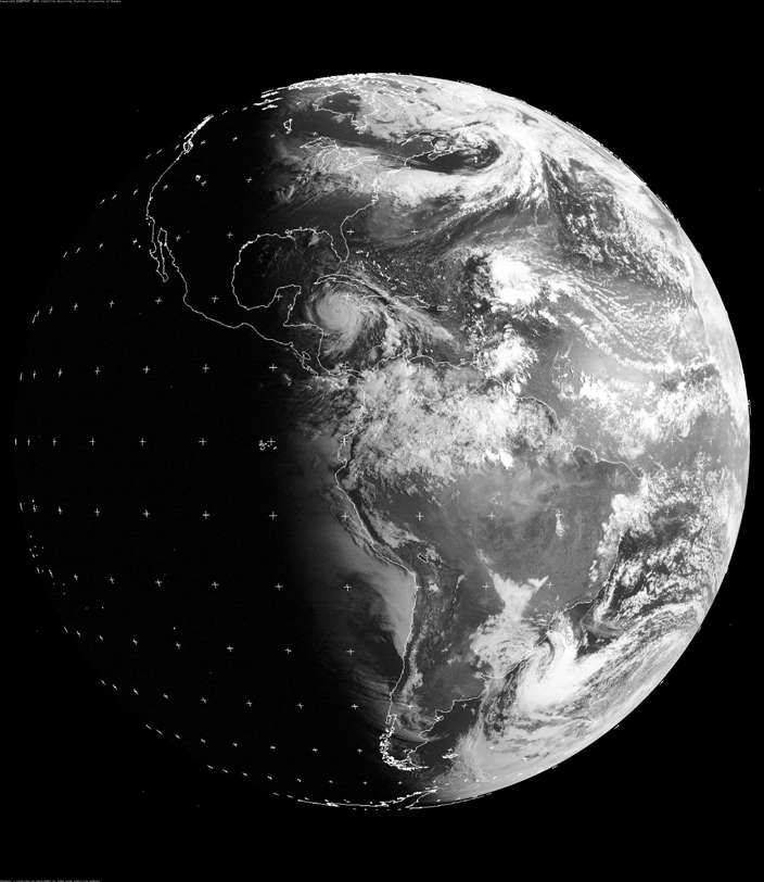 |
| caption | A visible image taken from the geostationary satellite GOES East (placed over the east coast of America, longitude 75° W) at 1200 UTC on 20 August 2007. The outlines of countries are overlaid and there is also a grid of reference marks (+). This image is illuminated by sunlight and the brightness indicates the amount of light that has been scattered back to the satellite; clouds appear white and the oceans (where cloud-free) appear darker than the land. Dawn is just breaking in the Caribbean, where Hurricane Dean, a Category 5 storm, can be seen between Cuba and Central America. |
| code | MI025 |
| Section | Meteorological instruments |
| Subsection | Satellites |
| image credit | © 2007 EUMETSAT |
| thumbnail |  |
| File | |