

Image bank
This is Watching the weather's image bank. If you want to return to the unit, please click here.
record 37 of 38
| image title | Infrared image from GOES East |
| image |  |
| caption | An infrared (IR) image taken from the geostationary satellite GOES East (placed over the east coast of America, longitude 75° W) at 1200 UTC on 20 August 2007. The outlines of countries are overlaid and there is also a grid of reference marks (+). Over the disk of the Earth, lighter colours have been used to indicate colder temperatures, as is conventional in IR images, and space is coloured white as the coldest part of the image. The high, cold clouds above Hurricane Dean and other tropical systems are especially apparent, as is a swirl of high cloud associated with a North Atlantic weather system. |
| code | MI027 |
| Section | Meteorological instruments |
| Subsection | Satellites |
| image credit | © 2007 EUMETSAT |
| thumbnail | 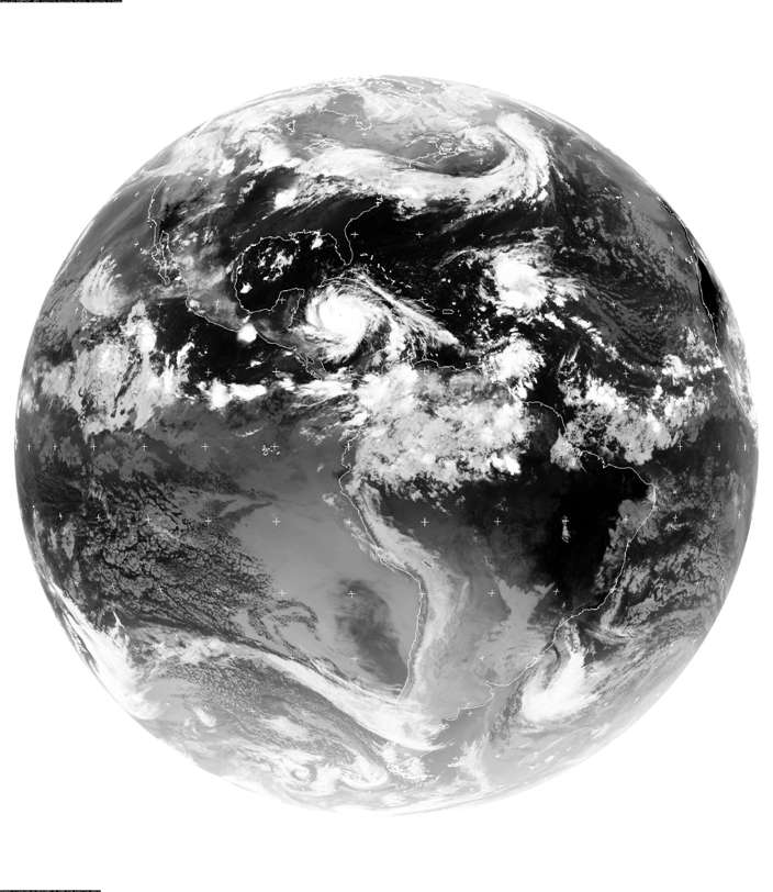 |
| File | |