
4.1 How it all began: a tale of why resolution matters
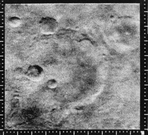
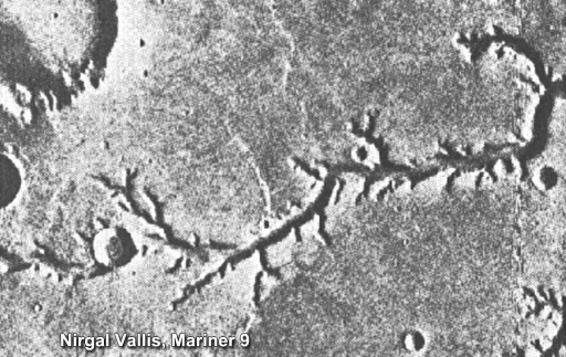
In the 1960’s, the space race between the United States of America (USA) and the Soviet Union helped fuel Solar System exploration, including of Mars. In 1964, NASA’s Mariner 4 was the first spacecraft to perform a fly-by mission of Mars and its cameras took 21 images from a distance of over 9800 km above the planet. From this distance, the images (e.g., Figure 13) could only resolve kilometre-sized objects, which were mainly impact craters. Disappointingly, there were no features that might suggest water. However, when Mariner 9 became the first spacecraft to orbit Mars in 1971, the photos it took from about 1500 km above ground revealed something different: river channels (Figure 14).
Five years later, in 1976, two Viking orbiters took images with unprecedented resolution. They mapped the entire surface of Mars at a resolution of 200 m per pixel, with some at 8 metres per pixel, and, for the first time, Mars was imaged in colour. These improvements allowed for much more detailed interpretation of images, confirming the presence of features formed by water on Mars.
Activity 4: How old is the surface of Mars?
Take a look again at Figure 14. If you look at the mid-sized crater towards the left of the image, about a third of the image up from the ‘l’ in Nirgal, you will notice that this crater appears to overlap and truncate the river channel. This means the impact must have happened after the channel was formed, and the impact is therefore younger than the channel.
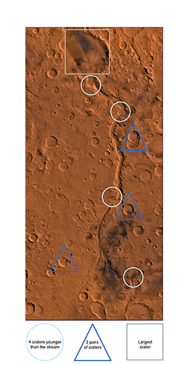
Using this same principle, look at Figure 15.
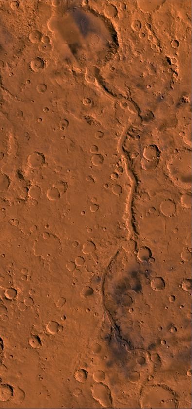
Can you find:
- A crater that is younger than the stream?
- Pairs of craters where one is younger than the other?
- A crater that is younger than Gusev Crater?
Answer
Figure 16, below, shows:
- four craters younger than the stream, labelled with a white circle.
- a blue triangle around three pairs of craters where one superimposes the other.
- a grey square around the largest of the craters that is younger than Gusev Crater.
You may have found different examples of each of these – there are many to find and each gives a relative age to the surface of Mars.
Regions that have accumulated many craters are relatively older than surfaces that have accumulated fewer craters. This has led to Mars being divided into three eons: the Noachian (4.1–3.7 billion years ago) as the oldest era, followed by the Hesperian (3.7–2.9 billion years ago) and the Amazonian (2.9 billion years ago to now).
The two Viking orbiters also delivered two landers to the surface of Mars: Viking 1 and Viking 2. Although they were not designed to search for water, the data they returned is key to our story, as you will learn next.