

1 Observing Mars from Earth
Mars appears like a star when observed with the naked eye, but it is impossible to discern any details. The first person to take a closer look at Mars with a telescope was Galileo Galilei, in 1609. As astronomers developed better telescopes, they were able to see distinct features on Mars and used these to calculate key information such as its rotation period and axial tilt. Table 1 shows some of the key data we now have about Mars, updated from the 1600s as technology and our understanding of the Solar System has improved.
| Earth | Mars | |
| Average distance from Sun (km) | 1.50 × 10⁸ | 2.27 × 10⁸ |
| Orbital period (length of year, Earth days) | 365 | 687 |
| Rotation period (length of day, hours:min) | 23:56 | 24:37 |
| Axial tilt | 23.44° | 25.19° |
| Equatorial radius (km) | 6378 | 3397 |
| Average surface temperature (°C) | 14 | −63 |
| Atmospheric pressure* | 1013 mbar/1 atm | 7.5 mbar/0.006 atm |
| Atmospheric composition | carbon dioxide 0.04% nitrogen 78% argon 0.9% oxygen 21%
|
carbon dioxide 95% nitrogen 2.6% argon 1.9% oxygen 0.16% carbon monoxide 0.06% |
| Satellites | The Moon | Phobos and Deimos |
Footnotes
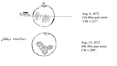
*The SI unit of pressure is actually the Pascal (Pa) and 1 atmosphere is 101 325 Pa.On 13 August 1672, Dutch astronomer Christiaan Huygens observed a white spot at Mars’ south pole (Figure 3). This was the first sign that ice might be present on the planet, and was a finding corroborated by Giacomo Miraldi in the early 18th century. It is now known that there is also an ice cap at Mars’ north pole, and that the ice caps are made of a mixture of water ice and dry ice (frozen carbon dioxide). You will hear more about this later.
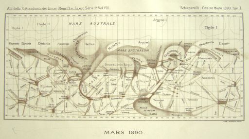
Improvements in the size and quality of telescopes throughout the 19th century allowed more detailed studies of the red planet. Among the most famous, and significant in the search for water – and life – on Mars, is that of Giovanni Schiaparelli. His global map of the planet’s surface (Figure 4) displayed a number of straight lines, which he called ‘canali’ (Italian for channels).
-
Can you think of reasons why astronomers of Schiaparelli’s time thought they saw lines on Mars?
-
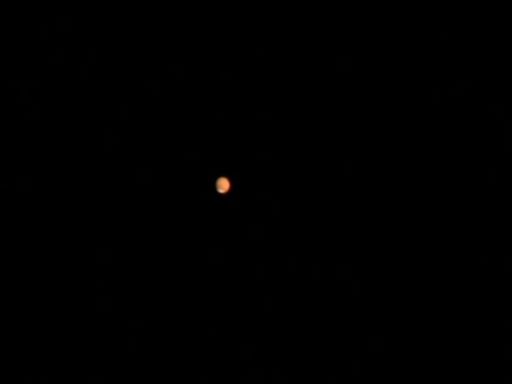
The telescopes available in the 19th century were unable to distinguish small features on Mars and they therefore appeared to be thin lines. These were then interpreted as straight lines. Figure 5, taken with a telescope comparable to the one Schiaparelli used (although much more recently) gives you an idea what Mars may have looked like for observers during the late 19th century.
The word ‘canali’ used by Schiaparelli was mistakenly translated to ‘canals’, which implied the presence of significant amounts of water and a civilisation capable of shaping the planet. Naturally, excitement grew around the theory of a martian civilisation. American astronomer Percival Lowell was its most fervent advocate and believed that the canals were swaths of vegetation and that the intelligent beings inhabiting the planet would resort to irrigation to survive the otherwise harsh conditions on Mars. However, the ‘canali’ proved to be elusive to other skilled observers, who argued that the straight lines were an optical illusion. In the early 20th century, Eugène Antoniadi was able to show that the features on Mars were of irregular shapes rather than straight lines and that there were no canals, or civilisations. Despite this, the search for water has continued and the next section of this course will help you understand why it remains central to many missions to the red planet.